Mountain
Assessment Info
Roll |
LSD Address |
Value |
Area |
Tax Codes |
Owned by |
Lat,Long |
Notes |
|---|---|---|---|---|---|---|---|
2095000 |
$262,700 |
40ac |
R LAND 02 T 300 Vacant Residential |
Individual |
49.600610, -114.424496 |
2103000100, upper east/right corner |
|
2095200 |
$235,100 |
40ac |
R LAND 02 T 300 Vacant Residential |
Individual |
49.600594, -114.435960 |
2086000000, upper west/left corner |
Note
R = Zoned Residential
LAND = Land only
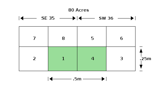
40 Acres = 0.25 square mile
LSD = Legal Sub Division
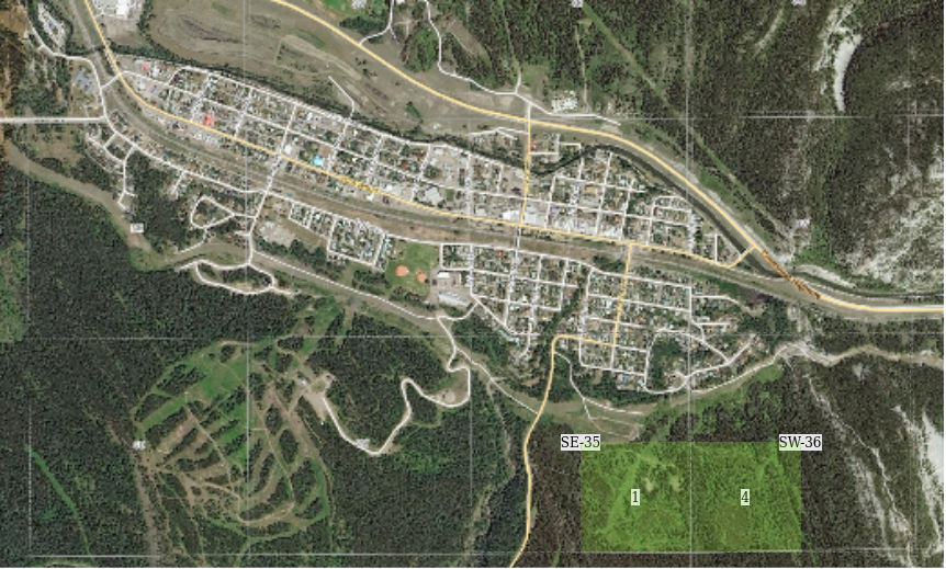
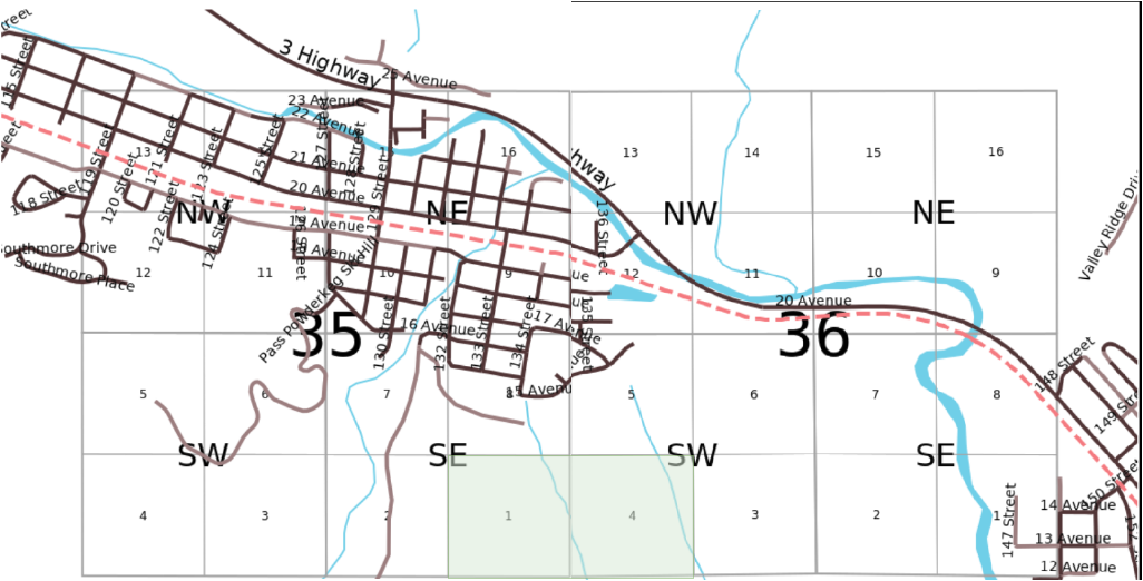
1-SE-35 | 4-SW-36
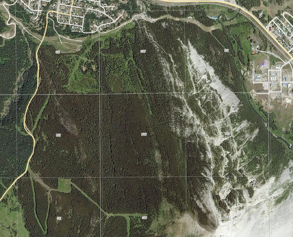
Map Annotated
Map notes:
SE-35 SW-36
+---------+---------+---------+---------+
| | | | |
| 7 | 8 | 5 | 6 |
| | | | |
+---------+---------+---------+---------+ -
| | | | | ^
| 2 | 1 * | 4 * | 3 | .25m
| | | | | v
+---------+---------+---------+---------+ -
|<-------.5m------->|
Sector (640ac) Quarter (160ac)
+----+----+----+----+ ^ +---------+---------+ ^
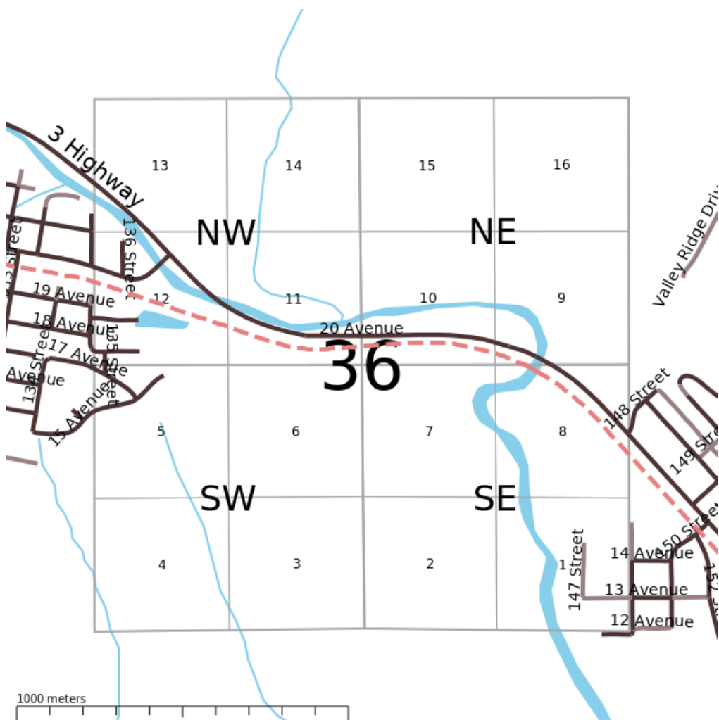
| 13 | 14 | 15 | 16 | | | | | |
+--- NW --+--- NE --+ | | 5 | 6 | |
| 12 | 11 | 10 | 9 | | | | | |
+----+----+----+----+ 1m +---------+---------+ .5m
| 5 | 6 | 7 | 8 | | | | | |
+--- SW --+--- SE --+ | | 4 | 3 | |
| 4 | 3 | 2 | 1 | | | | | |
+----+----+----+----+ v +---------+---------+ v
<---------1m--------> <--------.5m-------->
Note
1 miles = 1.6 km
Other Views
Map 1 |
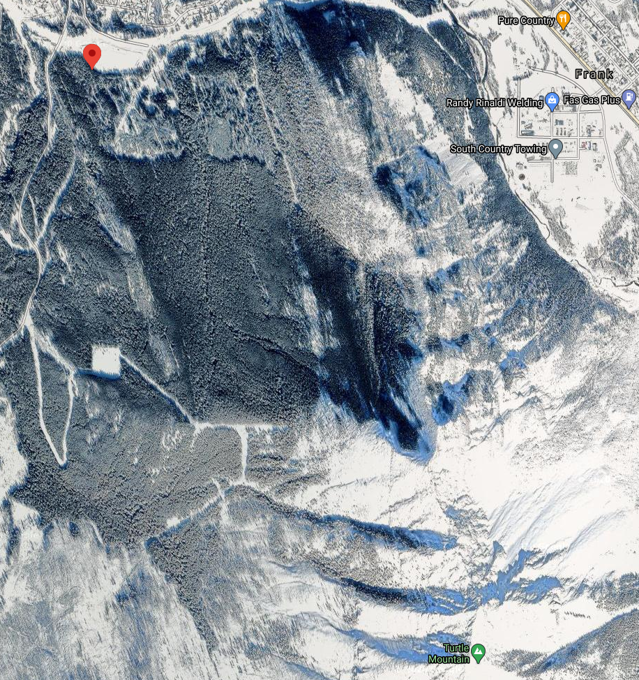
Turtle Mountain View |
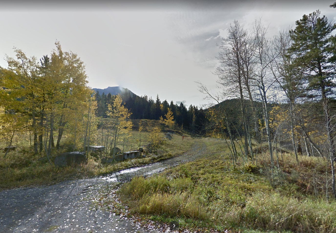
Street View |
Both Annotated |
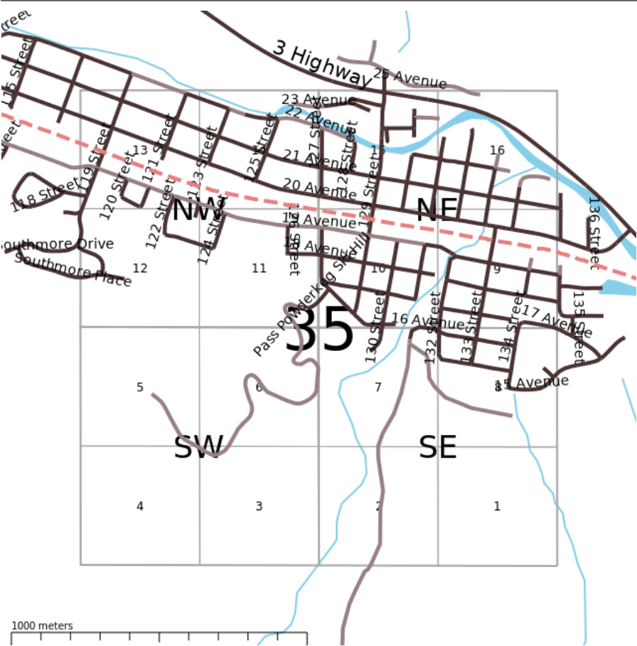
SE-35 |
SW-36 |
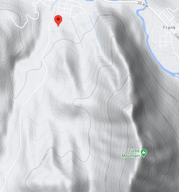
Terrain |
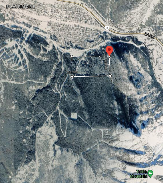
View 2 |
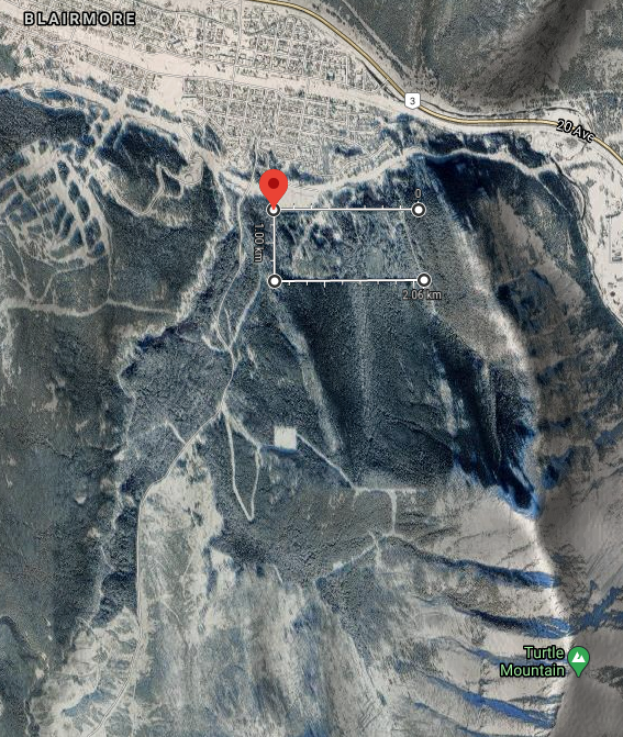
View 3 |
View 4 |
Notes
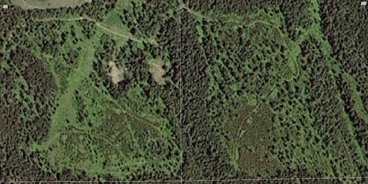
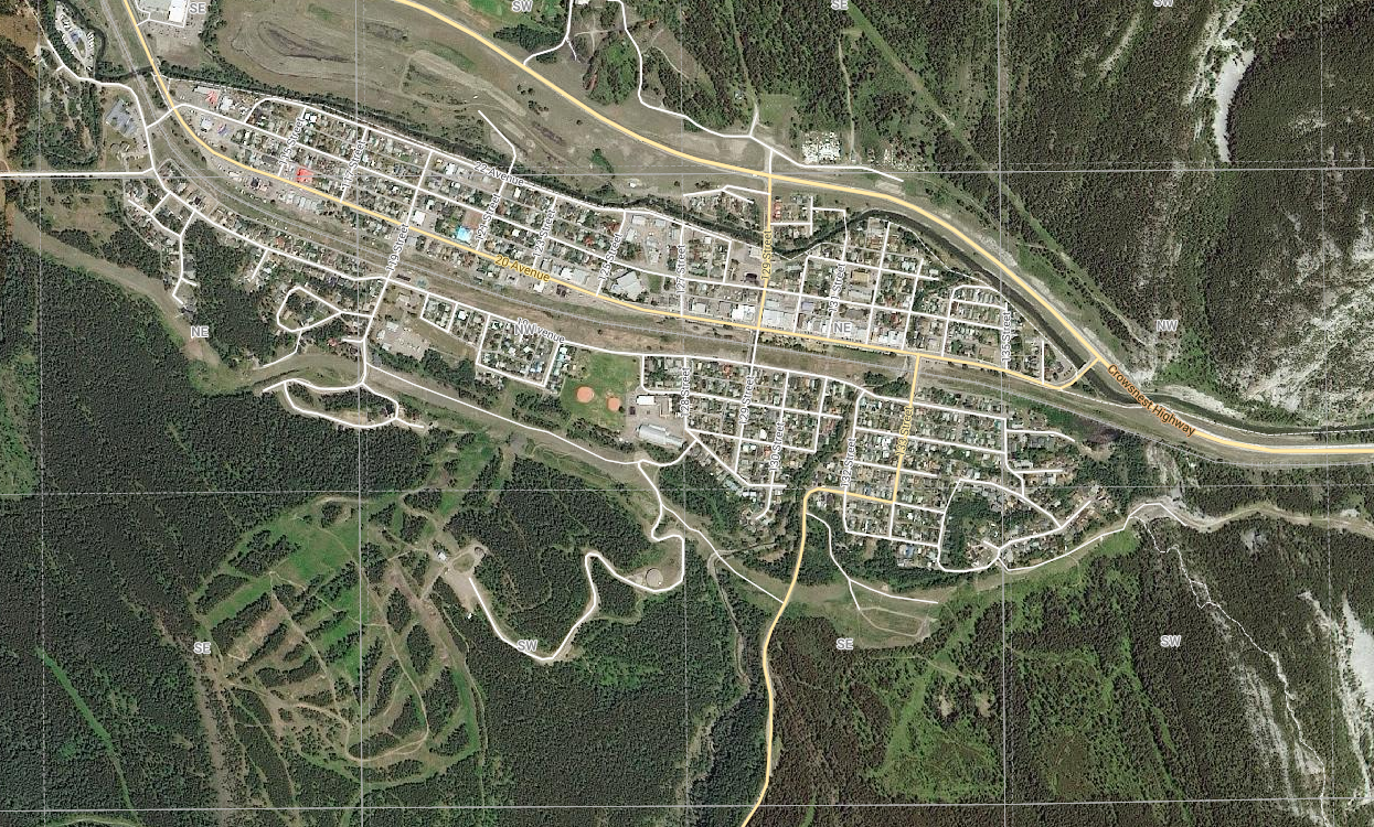
1-SE-35 is cheaper? seems to be sand/gravel pits or rocks which reduces the build-able area? the pipeline?
2 small creeks/streams?
most of the land seems to be mostly cleared of trees ( confirmed: it was logged )
many trails/paths/roads seem to exist, being used by motorbikes and atv's already?
quite close to town
change in elevation is slight ( hilly, rather than mountainous )
Powder-Keg Ski Hill close by ( has leases from ASRD land, and Devon )
what lands are owned by?: Alberta Sustainable Resource Development lands
what lands are owned by?: Devon Development Corporation
Alberta Winter Games? Other Events hosted in the Pass?
              |<----------Blairmore------------->|
           34                    35                    36              Sectors
+----------+----------+----------+----------+----------+----------+
|          |          |          |          |          |          |
|    NW    |    NE    |    NW    |    NE    |    NW    |    NE    |    Quarters
|          |          |          |          |          |          |
+----------+----------+----------+----------+----------+----------+
|          |          |          |    SE    |    SW    |          |
|    SW    |    SE    |    SW    |    +-----|-----+    |    SE    |    Sixteenths
|          |          |          |    |  1  |  4  |    |          |
+----------+----------+----------+----+-----+-----+----+----------+
               <-powderkeg->          |<-- .5m -->|
                 ski hill                 land
        SE-35               SW-36
+---------+---------+---------+---------+
|         |         |         |         |
|    7    |    8    |    5    |    6    |
|         |         |         |         |
+---------+---------+---------+---------+ -
|         |         |         |         | ^
|    2    |    1 *  |    4 *  |    3    | .25m
|         |         |         |         | v
+---------+---------+---------+---------+ -
          |<-------.5m------->|
         35                  36
+----+----+----+----+----+----+----+----+
| 13 | 14 | 15 | 16 | 13 | 14 | 15 | 16 |
+--- NW --+--- NE --+--- NW --+--- NE --+
| 12 | 11 | 10 | 9  | 12 | 11 | 10 | 9  |
+----+----+----+----+----+----+----+----+
| 5  | 6  | 7  | 8  | 5  | 6  | 7  | 8  |
+--- SW --+--- SE --+--- SW --+--- SE --+
| 4  | 3  | 2  | 1* | 4* | 3  | 2  | 1  |
+----+----+----+----+----+----+----+----+